 NU is all about fresh perspectives. So is our website.

MTech GIS
MTech Geographic Information Systems
GIS has helped the government launch the National Spatial Data Infrastructure and Bharat Maps. Many more ambitious projects like Smart cities, Smart Agriculture, Swachh Bharat and state-wise land records management systems will require geospatial technological integration, , and therefore the demand for high-quality GIS professionals and researchers is expected to soar in the near future.
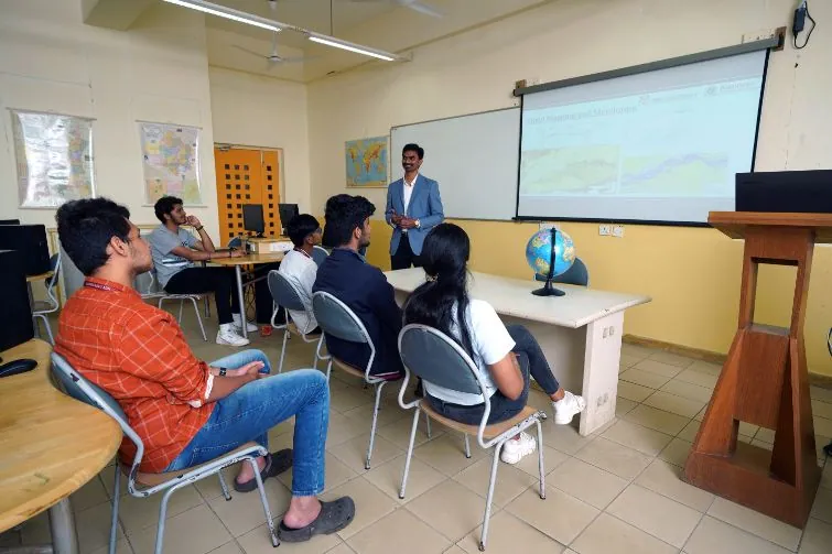
The MTech Geographic Information Systems (GIS) programme at NU aims to create a pool of highly qualified GIS professionals to fulfil this nation-building demand. NU’s global partnership with global organisations keeps the GIS programme, curriculum and facilities relevant, up to the minute. The NU’s MTech in GIS Programme is offered with support from Esri Inc., California, USA (the world’s leading organisation in the development of GIS software) and Esri India. Several other GIS organisations, involved in GIS development and its application in India and abroad, are also expected to join and support this unique research-driven and industry-linked programme in the near future. Read more
The MTech in GIS programme focuses on spatial visualisation, technology and applications of GIS, GPS fundamentals and techniques, Geospatial Project Management and field techniques like exploring the geospatial nature of regions, economy, demography, occupation profile, applications of GIS for humanities, and more. Graduates become fully prepared for positions as GIS Project Managers, Application Specialists, System Engineers and GIS Business Development Managers. They also have the option of pursuing Doctoral Research at NU.
NU’s Geographic Information Systems Vision
NU’s Geographic Information Systems Mission
- To provide cutting-edge education in GIS, fostering technological proficiency and critical thinking.
- To engage in groundbreaking research and innovative projects that address real-world spatial challenges in collaboration with government, industry and society.
- To cultivate an entrepreneurial mindset and support startups in the geospatial domain.
- To develop responsible global citizens by integrating seamless geospatial understanding and practices in addressing environmental and societal issues.
Programme outcomes
PO1
The ability to independently carry out research /investigation and development work to solve practical problems.
PO2
The ability to write and present a substantial technical report/document.
PO3
Demonstrate a degree of mastery over the area as per programme specialisation. The mastery should be at a level higher than that required by the appropriate bachelor programme.
Programme specific outcomes
PSO-1
Understand fundamental geospatial concepts and GIS tools to analyze spatial data and solve problems.
PSO-2
Apply advanced GIS techniques and tools to address real-world spatial challenges.
PSO-3
Analyze complex spatial datasets to interpret and derive meaningful insights for practical applications.
PSO-4
Evaluate various geospatial methods and technologies to determine their effectiveness and applicability in different contexts.
PSO-5
Design and develop innovative geospatial applications and solutions through original research and creative thinking.
Key differentiators
The programme is a perfect blend of curriculum, entailing classroom sessions, virtual classroom, internship and knowledge & skills in GIS area with strong industry practice and novel research. The programme is uniquely designed to provide academic competencies, workplace competencies, industry-wide technical competencies, industry-sector technical competencies and management competencies.
The first three semesters are devoted to theoretical and hands-on laboratory training of core and advanced GI Science and GI technology courses. The last semester is for industrial internship where students will be working on real-life projects leading to the completion of the programme. Thus, the MTech in GIS programme is the sum total of education measures undertaken to develop industry-ready GIS professionals. The overwhelming emphasis, therefore, is to ensure that all students ‘Learn to Learn’.
- On-campus component: NU firmly believes that experiential hands-on learning should be an integral part of all its courses. Students spend an entire year in the campus to carry out laboratory work. NU’s laboratories are designed more in the form of Industry Innovation Centres rather than just the laboratories. Further, the activities are designed as mini projects than isolated exercises.
- Virtual classroom component: NU has fully equipped web-conferencing studios to enable two-way interaction with its students located anywhere on the globe. This component is used to deliver lectures and carry out one-to-one student mentoring and guiding, as well as interacting with industry-supervisors in the fourth semester.
Apart from the core faculty, NU also has a vast network of global professionals drawn from the industry and academia who participate actively in the GIS Programme.
Programme outline
| Course category | Credits |
|---|---|
| Core courses (CC) | 32 |
| Professional electives (PE) | 9 |
| Open electives (OE) | 3 |
| Management (MGT) | 7 |
| Industry-linked (IP) | 12 |
| Humanities and Social Sciences (HSS) | 8 |
| Total credits | 72 |
Professional electives
- Cartography and Photogrammetry
- Remote Sensing and Digital Image Processing
- GIS, Geospatial Databases and Technology Trends
- GIS Programming
- Geostatistics, Geocomputation and Spatial Analysis
- Advanced Remote Sensing and Digital Photogrammetry
- Advanced GIS Programming
- Geospatial Field Techniques and Application Integration
Professional core courses
- Geoinformatics for Environment
- GIS for Humanities and Social Sciences
- GIS for Monitoring Natural Resource and Environmental Impacts
- Mobile GIS
Open electives
- Principles and Practices of DMS and Architecture around Data Management
- Business Environment and Fundamentals of Management
Programme architecture
Year I (Semester I & Semester II)
| # | Course code | Course | L | T | P | C |
|---|---|---|---|---|---|---|
| 1 | GIS 501 | Cartography and Photogrammetry | 2 | 0 | 2 | 3 |
| 2 | GIS 511 | Remote sensing and Digital Image Processing | 3 | 0 | 2 | 4 |
| 3 | GIS 521 | GIS, Geospatial Databases and Technology Trend | 2 | 0 | 4 | 4 |
| 4 | GIS 541 | GIS Programming | 2 | 0 | 4 | 4 |
| 5 | GIS 571 | Geostatistics, Geocomputation and Spatial Analysis | 2 | 0 | 2 | 3 |
| 6 | TA 531 | Oral and Written Communication | 3 | 0 | 0 | 3 |
| Total credits | 14 | 0 | 14 | 21 |
| # | Course code | Course | L | T | P | C |
|---|---|---|---|---|---|---|
| 1 | GIS 502 | Advanced Remote Sensing and Photogrammetry | 2 | 0 | 4 | 4 |
| 2 | GIS 512 | Advanced GIS platform programming | 2 | 0 | 4 | 4 |
| 3 | GIS 532 | Geospatial Field Techniques and Application integration | 2 | 0 | 4 | 4 |
| 4 | GIS 542 | GIS Project Management- I | 2 | 0 | 2 | 3 |
| 5 | GIS 562 | Professional Elective – 1 | 2 | 0 | 2 | 3 |
| 6 | GIS 611 | Professional Elective – 2 | 2 | 0 | 2 | 3 |
| 7 | TA 521 | Advanced Productivity Tools | 3 | 0 | 0 | 3 |
| Total credits | 15 | 0 | 18 | 24 |
Year II (Semester III & Semester IV)
| # | Course code | Course | L | T | P | C |
|---|---|---|---|---|---|---|
| 1 | GIS 631 | Professional Elective – 3 | 3 | 0 | 0 | 3 |
| 2 | GIS 621 | Open Elective 1 | 3 | 0 | 0 | 3 |
| 3 | MGT 601 | Open Elective 2 | 3 | 0 | 0 | 3 |
| 4 | GIS 601 | GIS Project Management – II | 2 | 0 | 4 | 4 |
| 5 | NU 522 | Contemporary Issues | 2 | 0 | 0 | 2 |
| 6 | MGT 582 | Technology Management | 3 | 0 | 0 | 3 |
| Total credits | 12 | 0 | 4 | 15 |
| # | Course code | Course | L | T | P | C |
|---|---|---|---|---|---|---|
| 1 | NU612 | Industry Practice / Project | 0 | 0 | 12 | 12 |
| Total credits | 0 | 0 | 12 | 12 |